December 2018
Interactive 3D Map
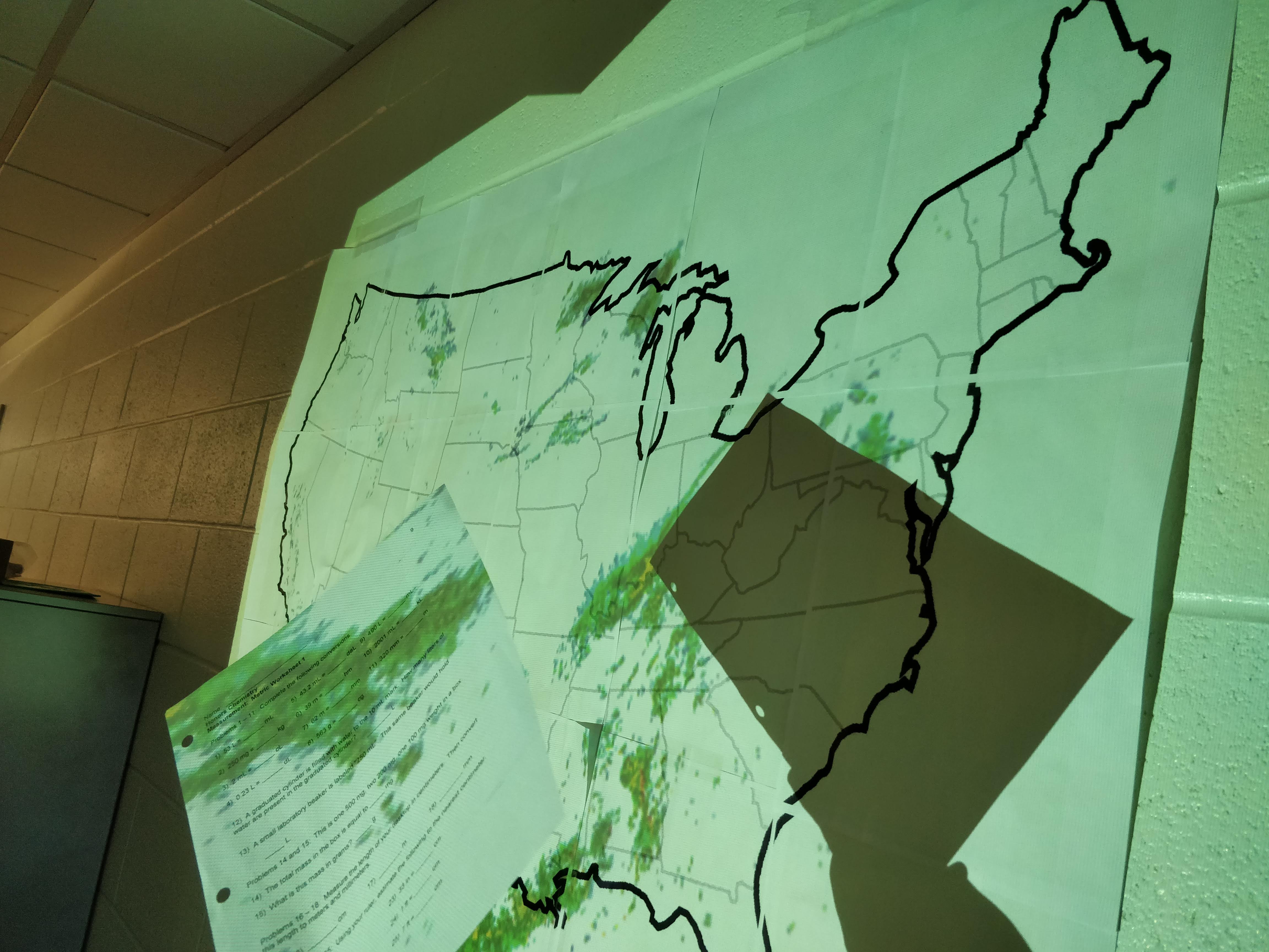
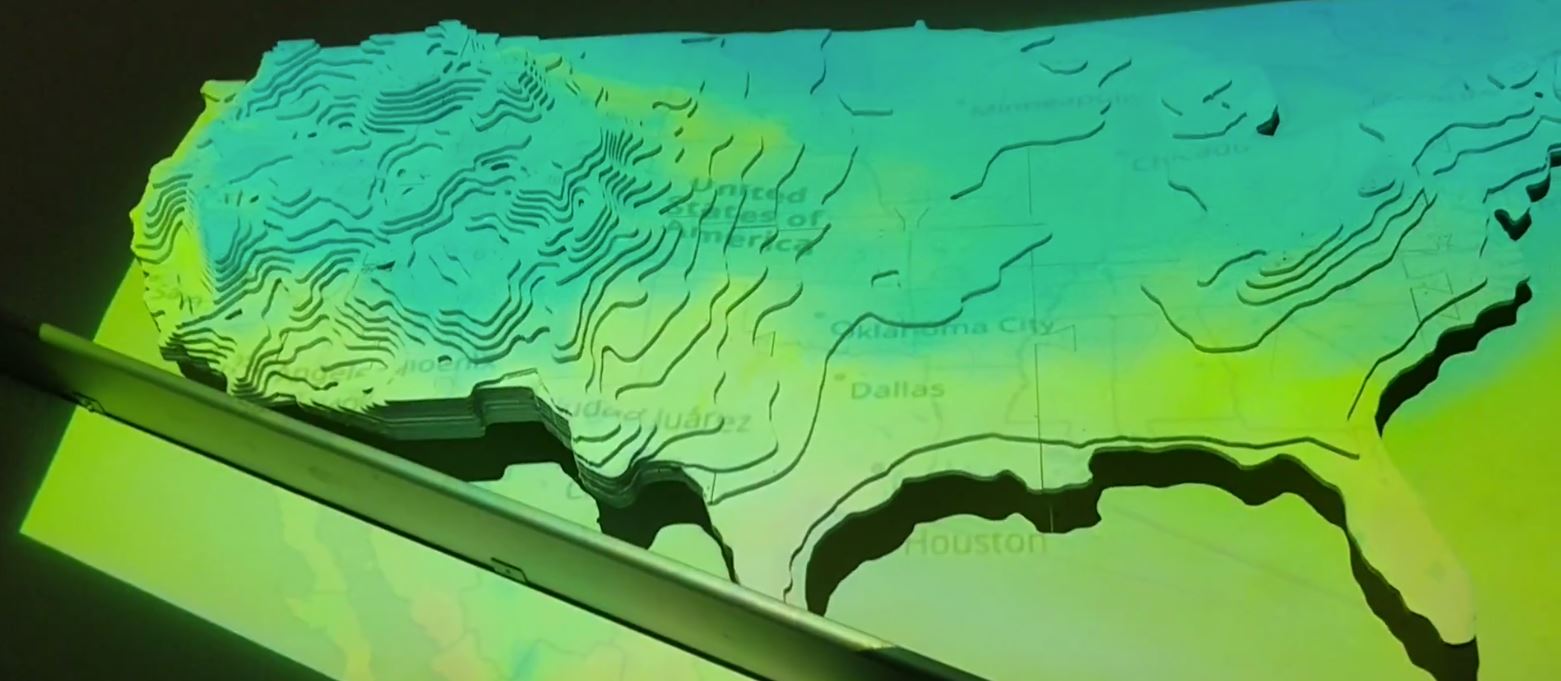
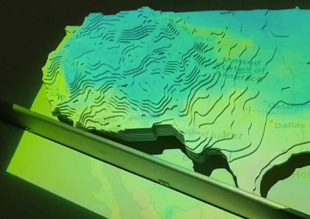
A large scale topographic map, combined with projections of real time nationwide weather
A large scale topographic map, combined with projections of real time nationwide weather
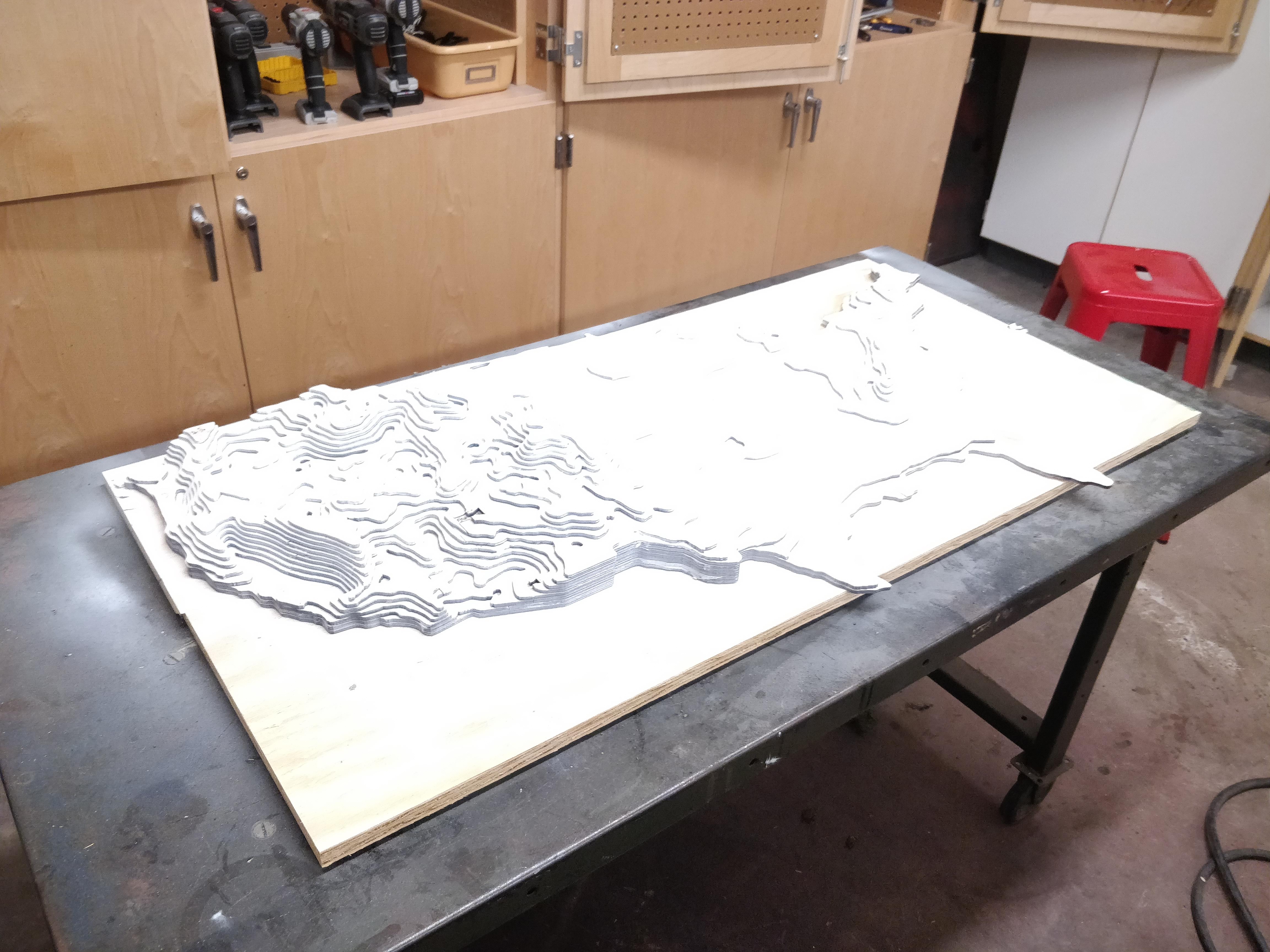
I undertook my 3D Topographic Map project during my high school engineering design course. The goal was to create a five foot wide wooden map which accurately modeled the terrain of the United States, and then be able to project a variety of different live weather patterns onto it to watch in real time how weather was unfolding across the country.
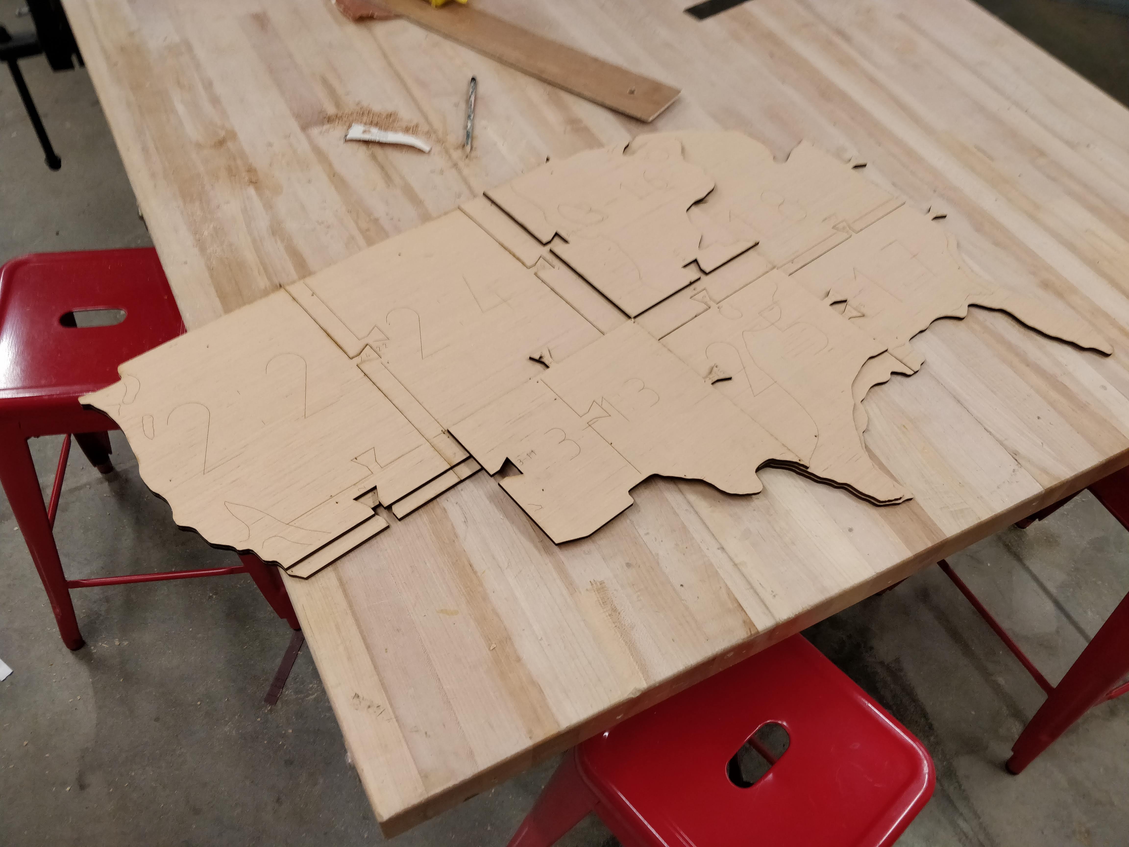
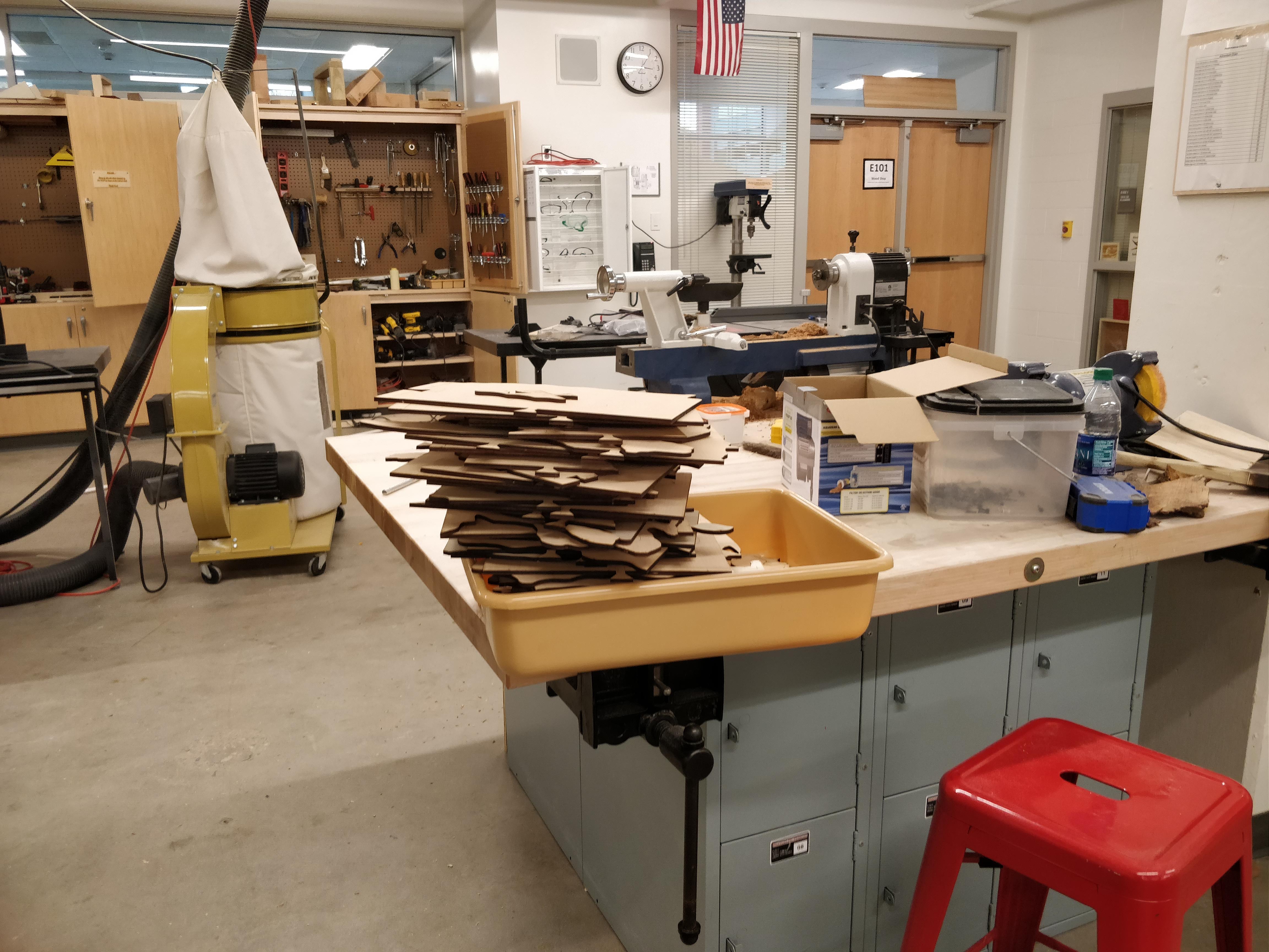
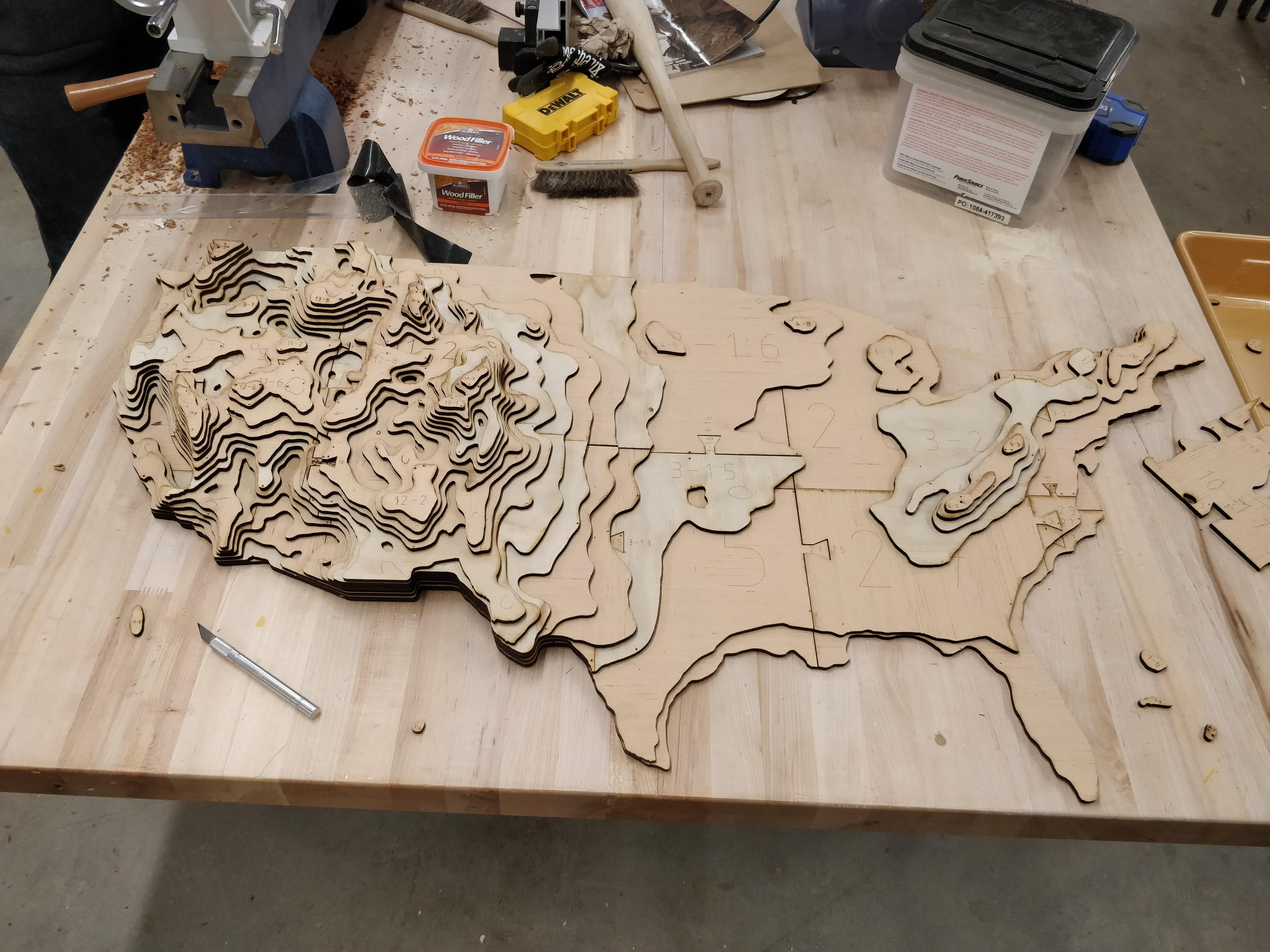
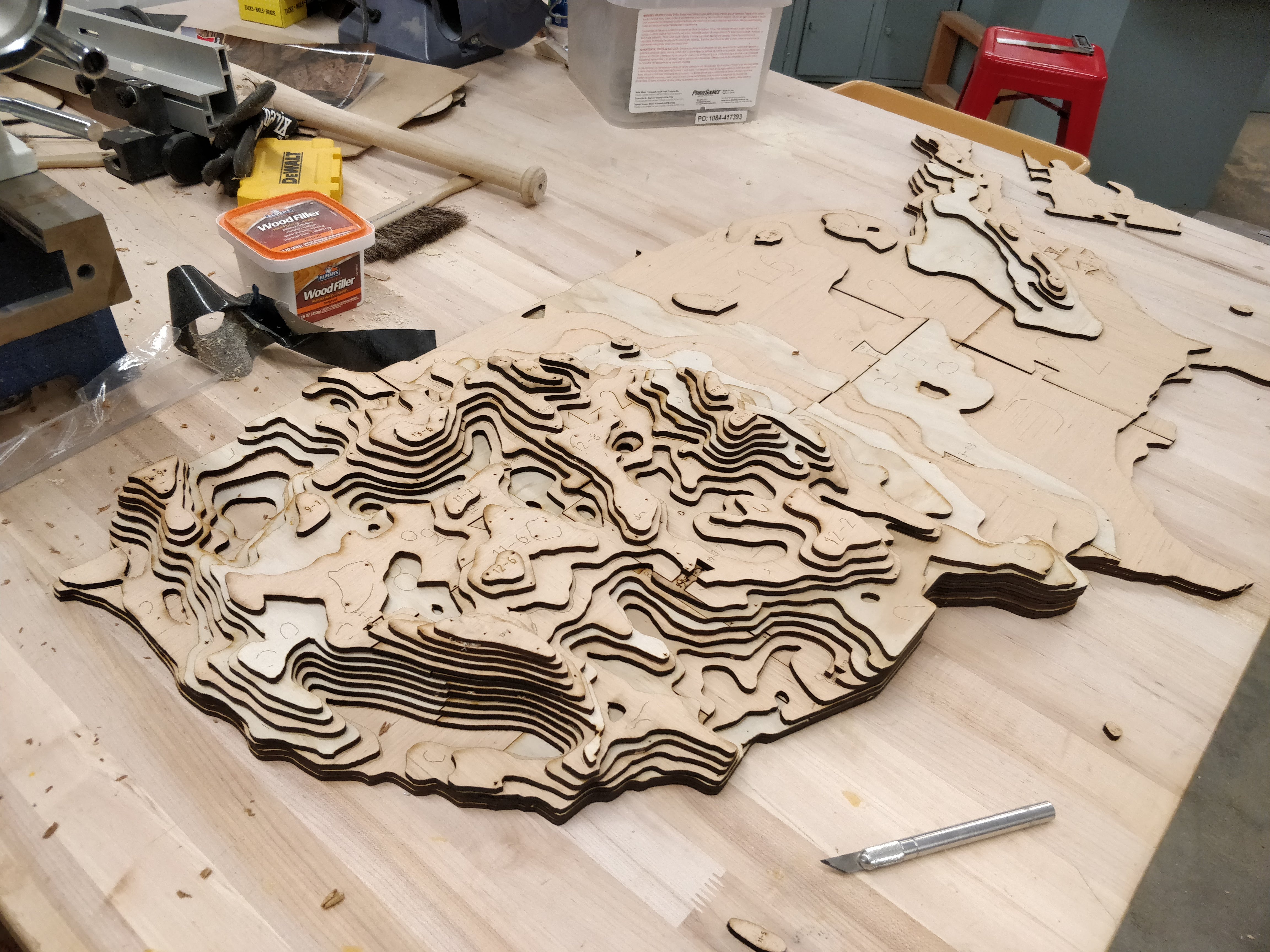
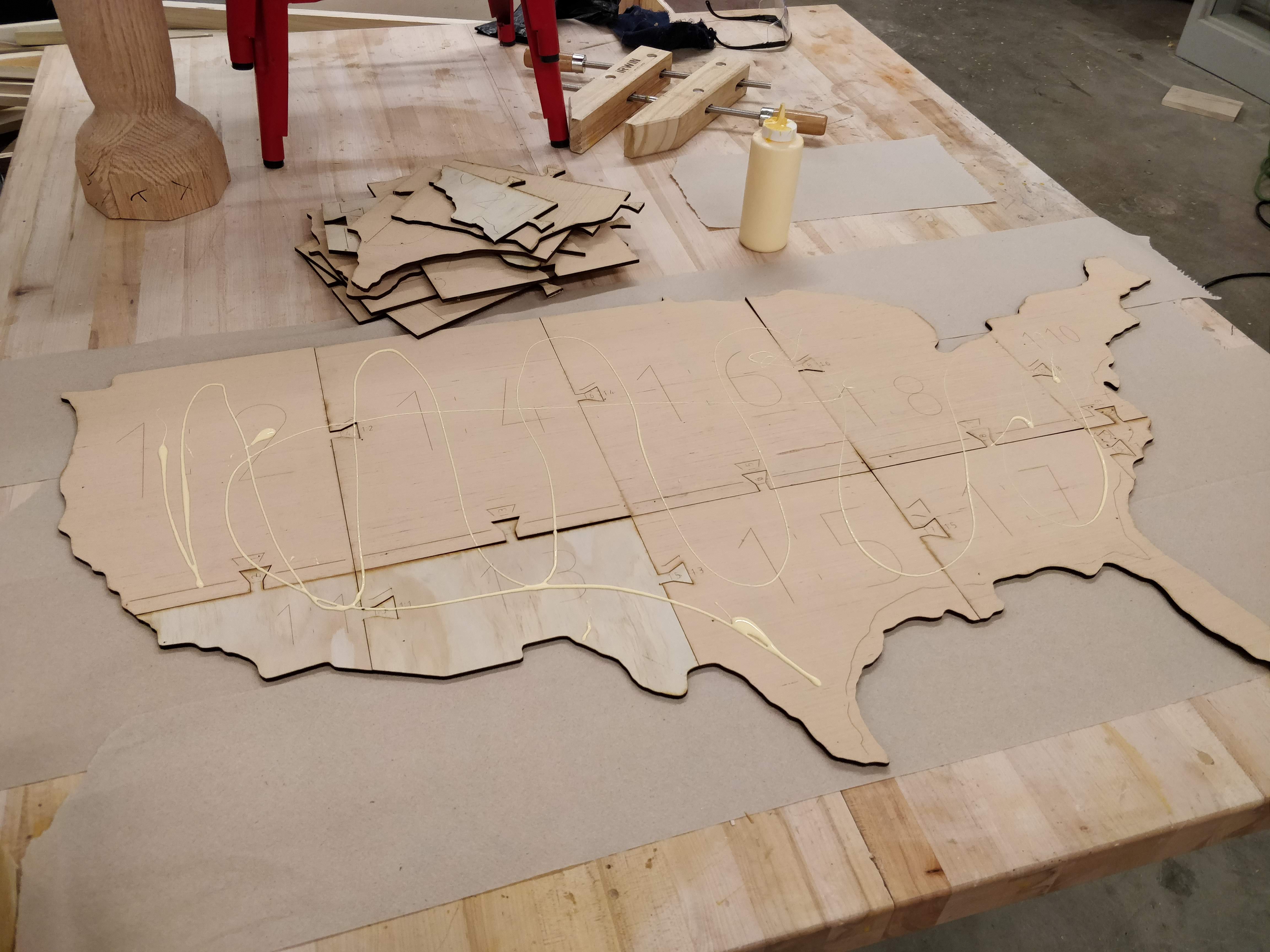
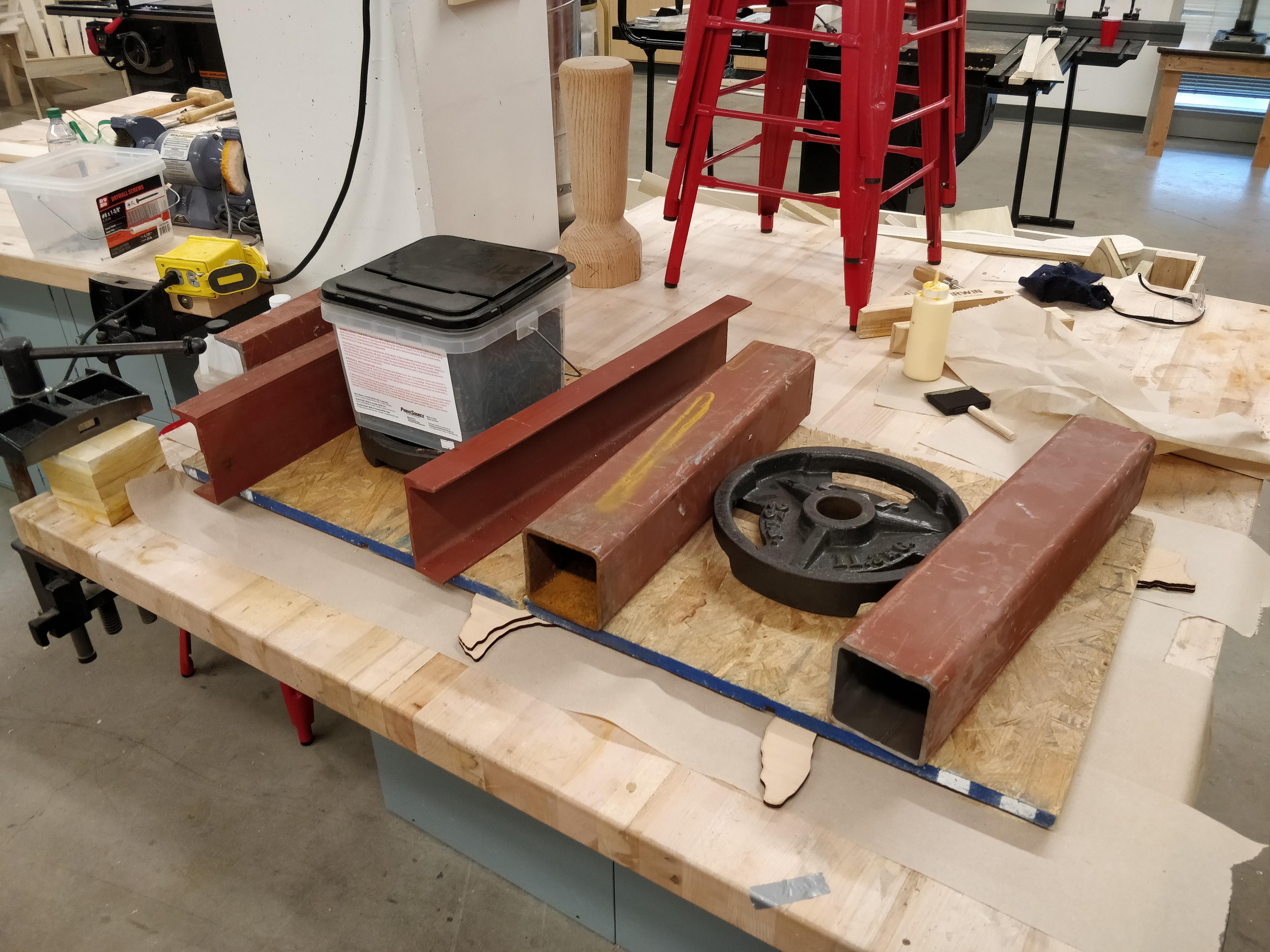
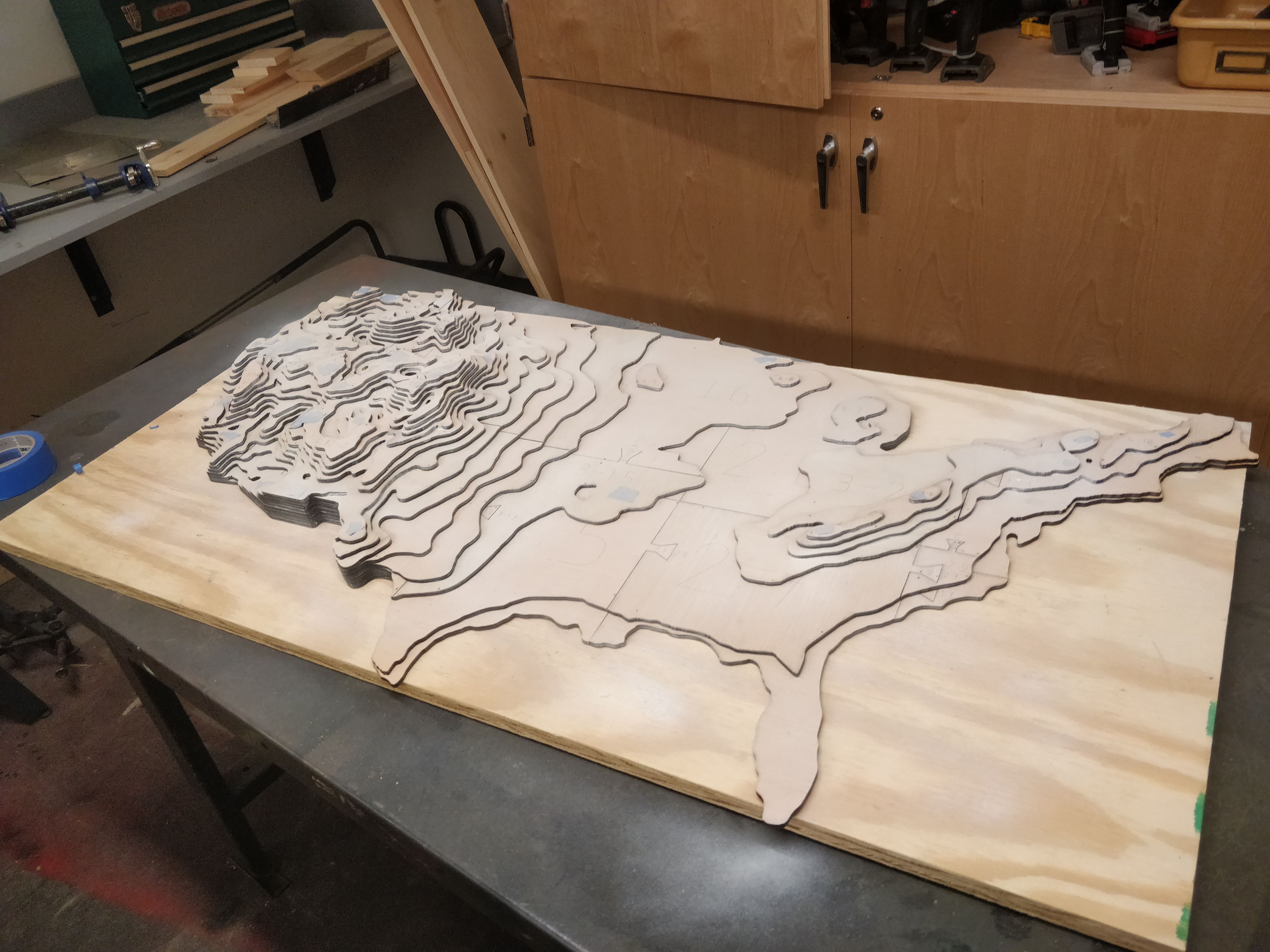
The first challenge was building the map itself. The map is made out of over 200 pieces, which are interlocked and stacked to create the realistic topography. These outlines of each layer were broken down into small enough pieces that they could fit on Winchester High’s miniature laser cutter to be cut out and marked. From there came a dry fit, followed by layer by layer glue ups, using heavy weights to keep everything as flat and even as possible. Afterwards, 6 coats of white spray paint made the surface ready for projection.
While the glue was drying I turned my attention to the software. While I was able to use Isadora, a commercial projection mapping software, to map any image to the surface of the map, one of the goals of the project was to be able to use a variety of different layers which updated in real time. To achieve this, I wrote a custom script to download images in real-time from Wikipedia’s political map, OpenWeatherMaps, and data published by Iowa State University. Using these APIs, my software downloaded specific tiles relevant to my map, stitched them together to form a map of the contiguous United States, manipulated them to make them bright and vibrant enough for projection, and passed the resulting imagery to Isadora for mapping. My software also implemented controls to allow for each different layer to be enabled or disabled, with transparency support for overlays.
The map can display the following data in real time:
This video contains a few clips of my development and testing process, and will soon be replaced by a more comprehensive demonstration.